


Select Theme
Current and future population figures, and a range of data from the 2011 Census.
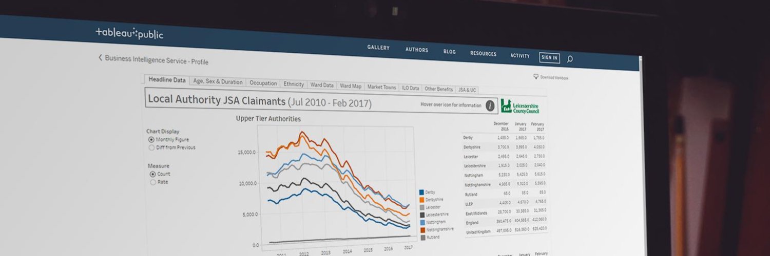
Data on employment, unemployment, earnings and hours worked.
Data on different types of crime, such as antisocial behaviour and domestic violence.
For information on deprivation, neighbourhood types, and urban and rural areas.
Information on how our councils are performing against targets.
Analysis of national and local surveys
Most Popular Reports
Leicestershire County Council Benchmarking Dashboards 2022/23
Tue, 26th Mar 2024
Leicestershire County Council Benchmarking Analysis 2022/23
Tue, 26th Mar 2024
Safer Communities Performance Report Quarter 3, 2023/24
Fri, 22nd Mar 2024
Environment & Climate Change Performance Report Quarter 3, 2023/24
Mon, 11th Mar 2024
Read More