Displaying 241 to 280 of 354
NWL Place "Tracking" Survey Spring 2010
Tue, 08 Jun 2010 14:58
Following the first National Place Survey carried out in 2008, North West Leicestershire District Council commissioned NWA Social Research to conduct a 'tracking' survey to monitor changes in opinion since the 2008 survey. The principal objective of the tracking survey was to collect data to calculate...
Crime Reduction Dashboards (Year End 2009/10)
Thu, 15 Apr 2010 17:13
The Crime Reduction Dashboards provide a visual indication of recorded crime figures against performance/reduction targets for the year-to-date. All seven districts of Leicestershire are covered along with Leicester City, and an overall view of Leicestershire and the Force Area. The local reduction targets...

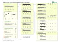
Anti-Social Behaviour Dashboard (Year End 2009/10)
Thu, 15 Apr 2010 17:11
The Anti-Social Behaviour (ASB) Dashboard provides a visual indication of the number of recorded ASB incidents against the previous year-to-date targets and long-term average. ASB incidents are broken down by category: Rowdy or Inconsiderate Behaviour, Vehicle Nuisance and Inappropriate Behaviour, Hoax...

Social Capital Survey Report 2010
Wed, 06 Jan 2010 15:57
As part of the Stronger Communities Block of the Leicestershire Local Area Agreement (LAA), the Communities and Voluntary Sector (CVS), DeMontfort University and Leicestershire County Council conducted a survey that attempted to baseline levels of social capital in 20 areas across Leicestershire. The...

Leicester and Leicestershire House Price and Sales Volume Monthly bulletin (October '09)
Mon, 28 Sep 2009 12:00
Using sales data, sourced from The Land Registry House Price Index (HPI), this report outlines house price and sales trends during a specified 12 month period. The HPI captures changes in the value of residential properties by analysing sales data collected on all residential housing transactions, whether...

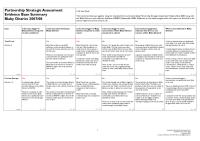
Leicestershire Community Safety Partnership Strategic Assessment 2009
Wed, 23 Sep 2009 11:31
The Partnership Strategic Assessment provides a summary of the crime, disorder and substance misuse issues across Leicestershire during 2008/09. The information within this assessment is designed to aid the Leicestershire Safer Communities Strategy Board to review current and develop future strategic...

Crime Reduction Dashboards (Year End 2008/9)
Mon, 08 Jun 2009 10:36
The Crime Reduction Dashboards provide a visual indication of recorded crime figures against performance/reduction targets. All seven districts of Leicestershire are covered along with Leicester City, and an overall view of Leicestershire and the Force Area.
For more information, please contact:
Karen...

Market Harborough Priority Neighbourhood Profile
Wed, 27 May 2009 13:52
The Market Harborough Priority Neighbourhood Profile for Central Market Harborough is now available. This profile provides a comprehensive overview of the Market Harborough intervention and monitoring areas. The report covers a range of useful baseline statistics for the area including information on...

Black Enterprise Leicestershire 2009
Wed, 15 Apr 2009 09:31
African Caribbean Citizens Forum (ACCF) commissioned this report to research Black owned enterprises in selected towns across Leicestershire with a view to establishing a feel for their number, gender participation and survival rates. ACCF also wanted to understand the kinds of barriers to start-up faced...

Leicester and Leicestershire House Price by Household Type (Jan 08 - Jan 09)
Mon, 23 Mar 2009 15:00
Using sales data sourced from The Land Registry House Price Index this report showcases trends for the 12 calendar months prior to January 2009. The HPI captures changes in the value of residential properties by analysing sales data collected on all residential housing transactions, whether for cash...

Leicester Residents' Survey 2008
Tue, 17 Mar 2009 12:50
Leicester City Council conducted a survey with NHS Leicester City to measure residents attitudes towards the council and its services. The report covers the satisfaction levels with the city council, the city as a place to live, community cohesion and safety.
Along with the documents attached, further...

Indices of Deprivation 2007: Analysis of Employment Domain
Thu, 12 Feb 2009 15:19
This report, forming part of a wider body of work on the IMD 2007, provides an analysis of the Employment domain within the Indices of Deprivation (2007).
This report uses IMD data to help better understand worklessness across Leicestershire. It looks at employment deprivation between and within the county...

Social Capital Survey 2007
Wed, 11 Feb 2009 15:58
As part of the Stronger Communities Block of the Leicestershire Local Area Agreement (LAA), the Communities and Voluntary Sector (CVS), DeMontfort University and Leicestershire County Council conducted a survey that attempted to baseline levels of social capital in 20 areas across Leicestershire.
Social...

Bluetooth proximity marketing campaign - Coalville Town Centre
Thu, 18 Dec 2008 10:14
This report provides an overview and analysis of a collaborative project by Leicestershire Drug and Alcohol Action Team (DAAT), Leicestershire County Council, North West Leicestershire Partnership in Safer Communities, Hinckley and Bosworth Community Safety Partnership and Leicestershire Police to pilot...

Bluetooth proximity marketing campaign - Hinckley Town Centre
Thu, 18 Dec 2008 09:49
This report provides an overview and analysis of a collaborative project by Leicestershire Drug and Alcohol Action Team (DAAT), Leicestershire County Council, Hinckley and Bosworth Community Safety Partnership, North West Leicestershire Partnership in Safer Communities and Leicestershire Police to pilot...
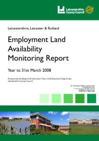
Employment Land Availability Report 2008
Tue, 09 Dec 2008 11:50
The Annual Employment Land Availability Report contains information on employment land supply, availability and development in Leicester, Leicestershire and Rutland. The latest report, covering the year to 31st March 2008, has been published. Land availability and development are measured against the...

Residential Land Availability Report 2008
Tue, 09 Dec 2008 11:46
The Annual Residential Land Availability Report contains information on residential land supply, availability and development in Leicester, Leicestershire and Rutland. The latest report, covering the year to 31st March 2008, has been published. Land availability and development are measured against the...

Leicestershire Community Safety : Evidence Base Summary 2008
Tue, 02 Dec 2008 13:59
This Community Safety Partnership Evidence Base Summary summarises the findings of the Leicestershire Community Safety Partnership Strategic Assessment 2008 for the Leicestershire County.

Leicestershire Community Safety Partnership Strategic Assessment 2008
Tue, 02 Dec 2008 13:59
The purpose of this Evidence-Base document is to provide Community Safety Partnerships within Leicestershire with a comprehensive, robust and accurate picture of crime and disorder issues across the county. This Evidence-Base report provides the fundamental information to form the basis of the Partnership...

Oadby and Wigston Crime and Disorder Reduction Partnership : Evidence Base Summary 2008
Tue, 02 Dec 2008 13:43
This Community Safety Partnership Evidence Base Summary summarises the findings of the Leicestershire Community Safety Partnership Strategic Assessment 2008 for the Oadby and Wigston Crime and Disorder Reduction Partnership.

North West Leicestershire Partnership in Safer Communities : Evidence Base Summary 2008
Tue, 02 Dec 2008 13:42
This Community Safety Partnership Evidence Base Summary summarises the findings of the Leicestershire Community Safety Partnership Strategic Assessment 2008 for the North West Leicestershire Partnership in Safer Communities.

Melton Area Safer Communities Partnership : Evidence Base Summary 2008
Tue, 02 Dec 2008 13:41
This Community Safety Partnership Evidence Base Summary summarises the findings of the Leicestershire Community Safety Partnership Strategic Assessment 2008 for the Melton Area Safer Communities Partnership.

Hinckley and Bosworth Community Safety Partnership : Evidence Base Summary 2008
Tue, 02 Dec 2008 13:40
This Community Safety Partnership Evidence Base Summary summarises the findings of the Leicestershire Community Safety Partnership Strategic Assessment 2008 for the Hinckley and Bosworth Community Safety Partnership.
For more information, please contact:
Karen Earp
Research and Insight Officer
Research and...

Harborough Community Safety Partnership : Evidence Base Summary 2008
Tue, 02 Dec 2008 13:40
This Community Safety Partnership Evidence Base Summary summarises the findings of the Leicestershire Community Safety Partnership Strategic Assessment 2008 for the Harborough Community Safety Partnership.
For more information, please contact:
Karen Earp
Research and Insight Officer
Research and Insight...

Charnwood Community Safety Partnership : Evidence Base Summary 2008
Tue, 02 Dec 2008 13:39
This Community Safety Partnership Evidence Base Summary summarises the findings of the Leicestershire Community Safety Partnership Strategic Assessment 2008 for the Charnwood Community Safety Partnership.
For more information, please contact:
Karen Earp
Research and Insight Officer
Research and Insight Team...
Blaby Community Safety Partnership : Evidence Base Summary 2008
Tue, 02 Dec 2008 13:38
This Community Safety Partnership Evidence Base Summary summarises the findings of the Leicestershire Community Safety Partnership Strategic Assessment 2008 for the Blaby Community Safety Partnership.
For more information, please contact:
Karen Earp
Research and Insight Officer
Research and Insight Team...
Education, Skills and Training in Leicestershire
Fri, 24 Oct 2008 10:11
This report provides an analysis of the Education, Skills and Training domain within the Indices of Deprivation (2007). This domain meaures both young people's education and adult skills. The analysis explores comparisons with IMD2004 and links to other related domains and datasets at Lower Super Output...

Income Deprivation Affecting Children in Leicestershire
Thu, 09 Oct 2008 09:45
The Indices of Deprivation 2007 (ID2007) is the collective name given to seven indices and two supplementary indices which are used to measure deprivation across England. The ID2007 are some of the most widely used data sets by local authorities to understand their communities and prioritise resources....

2001 Census Output Area Classifications
Fri, 03 Oct 2008 14:52
The 2001 Area Classifications were created on behalf of the Office of National Statistics by the University of Leeds. The classification is used to group together geographic areas according to key characteristics common to the population in that grouping. These groupings are called clusters, and are...

Key results from the Leicestershire Indices of Deprivation 2007
Sat, 27 Sep 2008 17:24
This report provides a more detailed analysis of overall deprivation in Leicestershire than the headline deprivation results released by the research team in January 2007. The new Index of Multiple Deprivation 2007 (IMD 2007) is one of the most widely used data sets by local authorities to understand...

Deprivation Change in Leicestershire Priority Neighbourhoods
Tue, 10 Jun 2008 09:37
This report examines the change in IMD (Indices of Multiple Deprivation) ranking between 2004 and 2007 within LAA Priority Neighbourhoods. The document provides an outline to the process of identifying Priority Neighbourhoods and the role played by IMD in the initial work as well as an overview of the...

North West Leicestershire Priority Neighbourhood Profile: Greenhill
Wed, 26 Mar 2008 09:14
The North West Leicestershire Priority Neighbourhood Profile for Greenhill is now available. This profile provides a comprehensive overview of the Greenhill intervention and monitoring areas. The report covers a range of useful baseline statistics for the area including information on demographics, deprivation,...

North West Leicestershire Priority Neighbourhood Profile: Coalville, Thringstone and Whitwick.
Wed, 26 Mar 2008 09:06
The North West Leicestershire Priority Neighbourhood Profile for Coalville, Thringstone and Whitwick is now available. This profile provides a comprehensive overview of the Coalville, Thringstone and Whitwick intervention and monitoring areas. The report covers a range of useful baseline statistics for...
Oadby and Wigston Priority Neighbourhood Profile: South Wigston
Fri, 07 Mar 2008 09:35
The Oadby and Wigston Priority Neighbourhood Profile for South Wigston is now available. This profile provides a comprehensive overview of the South Wigston intervention and monitoring areas. The report covers a range of useful baseline statistics for the area including information on demographics, deprivation,...

Oadby and Wigston Priority Neighbourhood Profile: Wigston
Fri, 07 Mar 2008 09:11
The Oadby and Wigston Priority Neighbourhood Profile for Wigston is now available. This profile provides a comprehensive overview of the Wigston intervention and monitoring areas. The report covers a range of useful baseline statistics for the area including information on demographics, deprivation,...

North West Leicestershire Priority Neighbourhood Profile: Castle Donington
Mon, 25 Feb 2008 15:25
The North West Leicestershire Priority Neighbourhood Profile for Castle Donington is now available. This profile provides a comprehensive overview of the Castle Donington intervention and monitoring areas. The report covers a range of useful baseline statistics for the area including information on demographics,...

Hinckley & Bosworth CSP Strategic Assessment
Mon, 25 Feb 2008 08:50
The Partnership Strategic Assessment provides knowledge and understanding of community safety problems that will inform and enable partners to develop their Community Safety Plan 2008-11

Rutland CSP Strategic Assessment
Mon, 25 Feb 2008 08:47
The Partnership Strategic Assessment provides knowledge and understanding of community safety problems that will inform and enable partners to develop their Community Safety Plan 2008-11

Charnwood CSP Strategic Assessment 2007
Mon, 25 Feb 2008 08:44
The Partnership Strategic Assessment provides knowledge and understanding of community safety problems that will inform and enable partners to develop their Community Safety Plan 2008-11

Hinckley and Bosworth Neighbourhood Profile: Burbage St. Catherine's
Wed, 13 Feb 2008 15:14
The Hinckley and Bosworth Priority Neighbourhood Profile for Burbage St. Catherine's is now available. This profile provides a comprehensive overview of the Burbage St. Catherine's intervention and monitoring areas. The report covers a range of useful baseline statistics for the area including information...