Displaying 241 to 280 of 301

Melton Priority Neighbourhood profile: South Melton (Zone 3)
Thu, 14 Jun 2007 13:05
The Melton Priority Neighbourhood Profile for Zone 3 (South Melton) is now available...
The Melton Priority Neighbourhood Profile for South Melton (Zone 3) is now available. This profile provides a comprehensive overview of the South Melton priority neighbourhood. The report covers a range of useful baseline...

Melton Priority Neighbourhood Profile: Town Centre Flats (Zone 2)
Thu, 24 May 2007 13:17
The Melton Priority Neighbourhood Profile for Zone 2 (Town Centre Flats) is now available...
The Melton Priority Neighbourhood Profile for Town Centre Flats (Zone 2) is now available. This profile provides a comprehensive overview of the Town Centre Flats priority neighbourhood. The report covers a range...

Melton Ward Profiles - Census 2001
Mon, 31 Jan 2005 15:45
1)The profiles below provide a summary of all the main Census topics for each ward in the District. The profiles have been compiled using the Key Statistics Tables series released by the Office of National Statistics in 2003 and also provide comparison figures for the District and County areas.
Please...

Mortality reports
Tue, 30 Apr 2013 15:37
Reports on the four most common causes of death (Cancer, Cardio Vascular Disease, Liver Disease and Respiratory Disease) for Leicestershire and Rutland. Describing trends, also benchmarking against similar areas in England

North West Leicestershire Electoral Divisions - 2011 Census Key Stats
Wed, 29 May 2013 15:17
These reports provide a broad overview of the 2011 Census Key Statistics data, released by the Office for National Statistics on 30th January 2013, as part of the Census Second Release. The reports summarise a selection of key headline datasets of this release for Leicestershire Electoral Divisions (EDs)....

North West Leicestershire Green Spaces Consultation Reports
Tue, 20 Dec 2011 16:10
The Government stated, in the Coalition Agreement, its intention to create a new designation to protect green areas of particular importance to local communities. Understanding which green spaces local people particularly value, and why, will help local communities and councils decide where new homes...

North West Leicestershire Neighbourhood Profile: Ashby
Mon, 17 Dec 2007 15:18
The North West Leicestershire Priority Neighbourhood Profile for Ashby is now available. This profile provides a comprehensive overview of the Ashby intervention and monitoring areas. The report covers a range of useful baseline statistics for the area including information on demographics, deprivation,...

North West Leicestershire Neighbourhood Profile: Measham
Mon, 17 Dec 2007 14:38
The North West Leicestershire Priority Neighbourhood Profile for Measham is now available. This profile provides a comprehensive overview of the Measham intervention and monitoring areas. The report covers a range of useful baseline statistics for the area including information on demographics, deprivation,...

North West Leicestershire Neighbourhood Profile: Moira
Tue, 22 Jan 2008 10:13
The North West Leicestershire Priority Neighbourhood Profile for Moira is now available. This profile provides a high level overview of the Moira intervention area. The report covers a range of useful baseline statistics for the area including information on demographics, deprivation, crime, economy,...

North West Leicestershire Parish Profiles - Census 2001
Mon, 31 Jan 2005 15:45
Simple 'Profiles' containing around 100 variables have been created for all Parishes in Leicestershire with at least 50 residents and 20 households. The themes covered are: People; Households; Work & Qualifications and Accommodation & Tenure. These profiles have not been released for higher geographies,...

North West Leicestershire Partnership in Safer Communities : Evidence Base Summary 2008
Tue, 02 Dec 2008 13:42
This Community Safety Partnership Evidence Base Summary summarises the findings of the Leicestershire Community Safety Partnership Strategic Assessment 2008 for the North West Leicestershire Partnership in Safer Communities.

North West Leicestershire Priority Neighbourhood Profile: Castle Donington
Mon, 25 Feb 2008 15:25
The North West Leicestershire Priority Neighbourhood Profile for Castle Donington is now available. This profile provides a comprehensive overview of the Castle Donington intervention and monitoring areas. The report covers a range of useful baseline statistics for the area including information on demographics,...

North West Leicestershire Priority Neighbourhood Profile: Coalville, Thringstone and Whitwick.
Wed, 26 Mar 2008 09:06
The North West Leicestershire Priority Neighbourhood Profile for Coalville, Thringstone and Whitwick is now available. This profile provides a comprehensive overview of the Coalville, Thringstone and Whitwick intervention and monitoring areas. The report covers a range of useful baseline statistics for...

North West Leicestershire Priority Neighbourhood Profile: Greenhill
Wed, 26 Mar 2008 09:14
The North West Leicestershire Priority Neighbourhood Profile for Greenhill is now available. This profile provides a comprehensive overview of the Greenhill intervention and monitoring areas. The report covers a range of useful baseline statistics for the area including information on demographics, deprivation,...

North West Leicestershire Profile: Ibstock
Wed, 08 Aug 2007 08:57
The North West Leicestershire Priority Neighbourhood Profile for Ibstock is now available...
The North West Leicestershire Priority Neighbourhood Profile for Ibstock is now available. This profile provides a comprehensive overview of the Ibstock intervention and monitoring areas. The report covers a range...

North West Leicestershire Ward Profiles - Census 2001
Mon, 31 Jan 2005 15:45
1)The profiles below provide a summary of all the main Census topics for each ward in the District. The profiles have been compiled using the Key Statistics Tables series released by the Office of National Statistics in 2003 and also provide comparison figures for the District and County areas.
Please...

NW Leicestershire CSP Strategic Assessment 2007
Fri, 18 Jan 2008 16:37
The Partnership Strategic Assessment provides knowledge and understanding of community safety problems that will inform and enable partners to develop their Community Safety Plan 2008-11

NW Leicestershire Electoral Division Profiles - Census 2001 Key Statistics
Mon, 31 Jan 2005 15:45
Following the recent boundary changes in Leicestershire, these area profiles provides a summary of the key data for an Electoral Division using the 2001 Census.
NWL Place "Tracking" Survey Spring 2010
Tue, 08 Jun 2010 14:58
Following the first National Place Survey carried out in 2008, North West Leicestershire District Council commissioned NWA Social Research to conduct a 'tracking' survey to monitor changes in opinion since the 2008 survey. The principal objective of the tracking survey was to collect data to calculate...

Oadby & Wigston CDRP Strategic Assessment 2007
Fri, 18 Jan 2008 16:40
The Partnership Strategic Assessment provides knowledge and understanding of community safety problems that will inform and enable partners to develop their Community Safety Plan 2008-11

Oadby & Wigston Community Safety Partnership Strategic Assessment 2011
Mon, 12 Mar 2012 15:26
The Partnership Strategic assessment is a statutory document produced annually to inform Community Safety Partnerships about crime, disorder and community safety issues in their area. The aim of this Strategic assessment is to provide Community Safety Partnerships with a comprehensive analysis of crime,...

Oadby & Wigston Community Safety Partnership Strategic Assessment – October 2012 - September 2013
Tue, 04 Mar 2014 16:51
The Partnership Strategic Assessment for Oadby & Wigston Borough brings together information regarding crime, disorder and community safety issues from across partner agencies to identify the longer-term issues impacting within the Borough as well as the scope of, and projections for crime, criminality...

Oadby & Wigston Electoral Division Profiles - Census 2001 Key Statistics
Mon, 31 Jan 2005 15:45
Following the recent boundary changes in Leicestershire these area profiles provides a summary of the key data for the four Oadby & Wigston Electoral Divisions, using the 2001 Census.

Oadby & Wigston Electoral Divisions - 2011 Census Key Stats
Wed, 29 May 2013 15:11
These reports provide a broad overview of the 2011 Census Key Statistics data, released by the Office for National Statistics on 30th January 2013, as part of the Census Second Release. The reports summarise a selection of key headline datasets of this release for Leicestershire Electoral Divisions (EDs)....

Oadby & Wigston Green Spaces Consultation Reports
Tue, 20 Dec 2011 16:10
The Government stated, in the Coalition Agreement, its intention to create a new designation to protect green areas of particular importance to local communities. Understanding which green spaces local people particularly value, and why, will help local communities and councils decide where new homes...
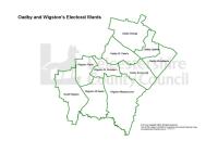
Oadby & Wigston Ward Profiles - Census 2001
Mon, 31 Jan 2005 15:45
1)The profiles below provide a summary of all the main Census topics for each ward in the District. The profiles have been compiled using the Key Statistics Tables series released by the Office of National Statistics in 2003 and also provide comparison figures for the District and County areas.
Please...

Oadby and Wigston Crime and Disorder Reduction Partnership : Evidence Base Summary 2008
Tue, 02 Dec 2008 13:43
This Community Safety Partnership Evidence Base Summary summarises the findings of the Leicestershire Community Safety Partnership Strategic Assessment 2008 for the Oadby and Wigston Crime and Disorder Reduction Partnership.
Oadby and Wigston Priority Neighbourhood Profile: South Wigston
Fri, 07 Mar 2008 09:35
The Oadby and Wigston Priority Neighbourhood Profile for South Wigston is now available. This profile provides a comprehensive overview of the South Wigston intervention and monitoring areas. The report covers a range of useful baseline statistics for the area including information on demographics, deprivation,...

Oadby and Wigston Priority Neighbourhood Profile: Wigston
Fri, 07 Mar 2008 09:11
The Oadby and Wigston Priority Neighbourhood Profile for Wigston is now available. This profile provides a comprehensive overview of the Wigston intervention and monitoring areas. The report covers a range of useful baseline statistics for the area including information on demographics, deprivation,...

Overseas migrant worker inflows to 2010
Thu, 11 Aug 2011 17:58
New registrations for National Insurance numbers by overseas nationals give an indication of the number of overseas workers in residence here for more than a year. The total number registering from January to December 2010 was over 7,000 in Leicester City and over 2,000 in Leicestershire County. The...

Partnership Strategic Assessment 2010-11
Mon, 15 Nov 2010 13:37
The Partnership Strategic Assessment for Leicester, Leicestershire and Rutland brings together information regarding crime, disorder and community safety from across partner agencies to identify the longer-term issues impacting on Leicester, Leicestershire and Rutland, as well as the scope of, and projections...

Physical Activity Needs Assessment
Mon, 15 Jul 2013
This report provides a health needs assessment (HNA) for physical activity and sport to support and inform a physical activity and sport strategy.
The aim of this HNA is to: identify met and unmet needs in adults and children related to physical activity and sport across Leicestershire and Rutland.
Evidence...

Places in Leicestershire Reports 2007
Fri, 14 Dec 2007 18:40
The Places in Leicestershire reports identify and highlight the priorities for individual places in Leicestershire, based on relevant and available data sources and information. The reports form part of the evidence base for the 2008 Leicestershire Sustainable Community Strategy, enabling identification...

Population Estimates Trends Updated to 2010
Tue, 02 Aug 2011 10:28
The Office for National Statistics (ONS) estimate of the mid-2010 population for Leicestershire is 648,700, and Leicester 306,600, with the Leicestershire and Leicester sub-region about 955,400 in estimated population. Office for National Statistics (ONS) published mid-2010 population estimates on 30th...

Reasons why people with dementia are admitted to a general hospital in an emergency
Thu, 10 Sep 2015
Leicestershire Public Health
In July 2015, Public Health England (PHE) published a briefing and data set looking at reasons for emergency admissions for dementia patients. This data briefing has been developed as partnership between NHS England and the Dementia Intelligence Network (DIN). The briefing presents the findings from...
Reducing Adult Reoffending
Wed, 17 Nov 2010 12:51
The report has been produced to help describe the adult offending and reoffending population of Leicester, Leicestershire and Rutland. Based on the demographics of individual offenders, characteristics of the communities in which offenders live and the criminogenic needs that these offenders, the report...

Report : Anti-Social Behaviour Dashboard (July 2011)
Fri, 02 Sep 2011 10:32
The Anti-Social Behaviour (ASB) Dashboard provides a visual indication of the number of recorded ASB incidents against the previous year-to-date and long-term average. ASB incidents are broken down into three categories: personal, nuisance and environmental. All seven districts of Leicestershire are...
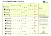
Report : Anti-Social Behaviour Dashboard (June 2011)
Thu, 04 Aug 2011 09:22
The Anti-Social Behaviour (ASB) Dashboard provides a visual indication of the number of recorded ASB incidents against the previous year-to-date and long-term average. ASB incidents are broken down into three categories: personal, nuisance and environmental. All seven districts of Leicestershire are...

Report : Anti-Social Behaviour Dashboard (September 2011)
Tue, 08 Nov 2011 12:50
The Anti-Social Behaviour (ASB) Dashboard provides a visual indication of the number of recorded ASB incidents against the previous year-to-date and long-term average. ASB incidents are broken down into three categories: personal, nuisance and environmental. All seven districts of Leicestershire are...

Report : Crime Reduction Dashboards (September 2011)
Tue, 08 Nov 2011 12:52
The Crime Reduction Dashboards provide a visual indication of recorded crime figures against performance/reduction targets for the year-to-date. All seven districts of Leicestershire are covered along with Leicester City, and an overall view of Leicestershire and the Force Area. The local reduction targets...